Geolocate

Argentona topographic map

Click on the map to display elevation.

About this map
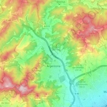
Name: Argentona topographic map, elevation, terrain.

Location: Argentona, Maresme, Barcelona, Catalonia, 08310, Spain (41.53048 2.35541 41.59531 2.42698)

Average elevation: 643 ft

Minimum elevation: 10 ft

Maximum elevation: 1,519 ft

Gear up for your next adventure:

🔥Plasma Lighters - Windproof lighters that work in any weather condition
🌡️Portable Weather Meter - Track weather conditions on the trail
🧭GPS Watch Accessories - Bands and chargers for GPS watches
🔭Telescopic Hiking Pole - Adjustable pole for hiking stability
📱Solar Portable Charger - Solar power bank for charging devices off‑grid

As an Amazon Associate, this site earns from qualifying purchases at no extra cost to you.