
Tannymorel topographic map
Interactive map
Click on the map to display elevation.
About this map
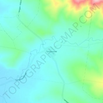
Name: Tannymorel topographic map, elevation, terrain.
Location: Tannymorel, Queensland, Australia (-28.31196 152.22719 -28.27196 152.26719)
Average elevation: 1,778 ft
Minimum elevation: 1,634 ft
Maximum elevation: 2,313 ft
Other topographic maps
Click on a map to view its topography, its elevation and its terrain.
Tannymorel
Australia > Queensland > Tannymorel
Tannymorel, Southern Downs Regional, Queensland, Australia
Average elevation: 1,808 ft