
Potawatomi State Park topographic map
Interactive map
Click on the map to display elevation.
About this map
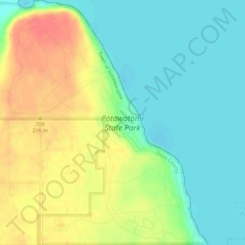
Name: Potawatomi State Park topographic map, elevation, terrain.
Average elevation: 640 ft
Minimum elevation: 564 ft
Maximum elevation: 755 ft
Other topographic maps
Click on a map to view its topography, its elevation and its terrain.
Whitefish Dunes State Park
United States > Wisconsin > Door County > Sturgeon Bay
Whitefish Dunes State Park, 3275, Clark Lake Road, Sturgeon Bay, Town of Sevastopol, Door County, Wisconsin, 54235, United States
Average elevation: 594 ft