
Montejunto topographic map
Interactive map
Click on the map to display elevation.
About this map
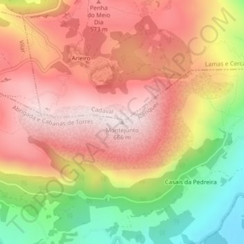
Name: Montejunto topographic map, elevation, terrain.
Location: Montejunto, Alenquer, Lisboa, 2550-371, Portugal (39.17331 -9.04864 39.17341 -9.04854)
Average elevation: 1,401 ft
Minimum elevation: 289 ft
Maximum elevation: 2,185 ft
Other topographic maps
Click on a map to view its topography, its elevation and its terrain.