
Robin Hood Park topographic map
Interactive map
Click on the map to display elevation.
About this map
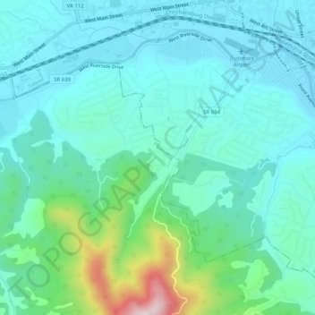
Name: Robin Hood Park topographic map, elevation, terrain.
Location: Robin Hood Park, Roanoke County, Virginia, 24153, USA (37.25041 -80.10226 37.29041 -80.06226)
Average elevation: 1,266 ft
Minimum elevation: 991 ft
Maximum elevation: 2,408 ft