Geolocate

Montecristi topographic map

Click on the map to display elevation.

About this map
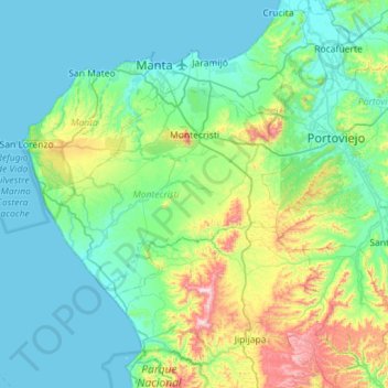
Name: Montecristi topographic map, elevation, terrain.

Location: Montecristi, Manabí, Ecuador (-1.28980 -81.08477 -0.98481 -80.51704)

Average elevation: 482 ft

Minimum elevation: 0 ft

Maximum elevation: 2,631 ft

Gear up for your next adventure:

🔭Telescopic Hiking Pole - Adjustable pole for hiking stability
🪶Fire Starter Kit - Reliable fire starter for survival and camping
⛺Backpacking Tent - Lightweight and durable tent for multi‑day hikes
🔪Outdoor Multitools - Essential survival tools for gear repair and field use
🧣Hiking Neck Gaiter - Multi‑use neck protection for outdoor weather

As an Amazon Associate, this site earns from qualifying purchases at no extra cost to you.