
Cerro de Abajo topographic map
Interactive map
Click on the map to display elevation.
About this map
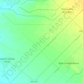
Name: Cerro de Abajo topographic map, elevation, terrain.
Location: Cerro de Abajo, Angostura, Sinaloa, Mexico (25.15642 -108.16176 25.22357 -108.08848)
Average elevation: 39 ft
Minimum elevation: 7 ft
Maximum elevation: 82 ft
Other topographic maps
Click on a map to view its topography, its elevation and its terrain.