
Pai Tau Wai topographic map
Interactive map
Click on the map to display elevation.
About this map
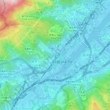
Name: Pai Tau Wai topographic map, elevation, terrain.
Location: Pai Tau Wai, Sha Tin District, Hong Kong, DD186 484, PRC (22.36395 114.16743 22.40395 114.20743)
Average elevation: 341 ft
Minimum elevation: -13 ft
Maximum elevation: 1,765 ft