Geolocate

Euskirchen topographic map

Click on the map to display elevation.

About this map

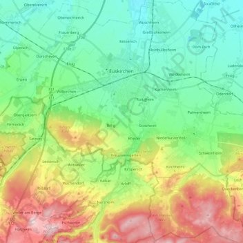
Name: Euskirchen topographic map, elevation, terrain.

Location: Euskirchen, Kreis Euskirchen, North Rhine – Westphalia, Germany (50.56055 6.71045 50.70298 6.93492)

Average elevation: 755 ft

Minimum elevation: 427 ft

Maximum elevation: 1,417 ft

Gear up for your next adventure:

🏔️Mountain Trail Maps - High‑detail maps for popular peaks
📻Weather Alert Radios - Stay informed of storm risks while off-the-grid
👟Men's Trail Runners - Lightweight footwear for fast-paced exploration and light hiking
🧴Hand Sanitizer - Keep hands clean while hiking
🌡️Portable Weather Meter - Track weather conditions on the trail

As an Amazon Associate, this site earns from qualifying purchases at no extra cost to you.