
Amriswil topographic map
Interactive map
Click on the map to display elevation.
About this map
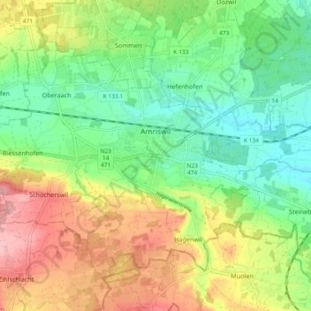
Name: Amriswil topographic map, elevation, terrain.
Location: Amriswil, Bezirk Arbon, Thurgovie, Suisse (47.52213 9.24740 47.56816 9.33957)
Average elevation: 1,552 ft
Minimum elevation: 1,365 ft
Maximum elevation: 1,827 ft