
Mugel topographic map
Interactive map
Click on the map to display elevation.
About this map
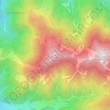
Name: Mugel topographic map, elevation, terrain.
Location: Mugel, Niklasdorf, Leoben, Estiria, 8712, Austria (47.35826 15.18817 47.35836 15.18827)
Average elevation: 4,160 ft
Minimum elevation: 2,854 ft
Maximum elevation: 5,394 ft