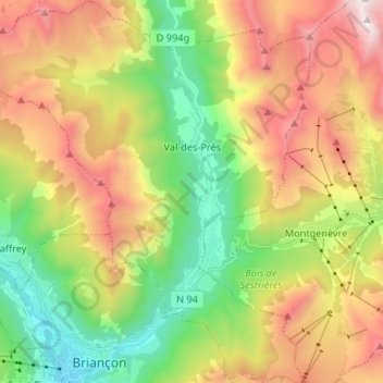
Val-des-Prés topographic map
Interactive map
Click on the map to display elevation.
About this map
Name: Val-des-Prés topographic map, elevation, terrain.
Average elevation: 6,496 ft
Minimum elevation: 3,937 ft
Maximum elevation: 9,931 ft

Click on the map to display elevation.
Name: Val-des-Prés topographic map, elevation, terrain.
Average elevation: 6,496 ft
Minimum elevation: 3,937 ft
Maximum elevation: 9,931 ft