
Gambegre topographic map
Interactive map
Click on the map to display elevation.
About this map
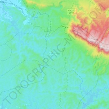
Name: Gambegre topographic map, elevation, terrain.
Location: Gambegre, West Garo Hills, Meghalaya, 794005, India (25.33038 90.00618 25.55342 90.31843)
Average elevation: 823 ft
Minimum elevation: 108 ft
Maximum elevation: 4,606 ft
Other topographic maps
Click on a map to view its topography, its elevation and its terrain.