
Punta Negra topographic map
Interactive map
Click on the map to display elevation.
About this map
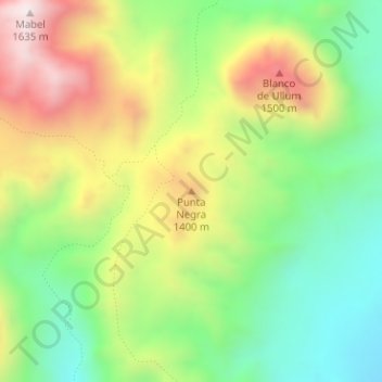
Name: Punta Negra topographic map, elevation, terrain.
Location: Punta Negra, Ullúm, San Juan, Argentina (-31.49188 -68.82899 -31.49178 -68.82889)
Average elevation: 4,052 ft
Minimum elevation: 3,068 ft
Maximum elevation: 5,404 ft
Other topographic maps
Click on a map to view its topography, its elevation and its terrain.
Barrio Retiro
Barrio Retiro, Santa Lucía, San Juan, Argentina
Average elevation: 2,054 ft
Bella Vista
Argentina > San Juan > Bella Vista
Bella Vista, Jáchal, San Juan, 5460, Argentina
Average elevation: 3,914 ft