
Gemeinde Sölden topographic map
Interactive map
Click on the map to display elevation.
About this map
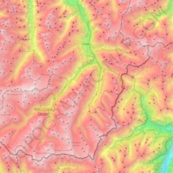
Name: Gemeinde Sölden topographic map, elevation, terrain.
Location: Gemeinde Sölden, Bezirk Imst, Tirol, Österreich (46.76285 10.72601 47.02239 11.16810)
Average elevation: 8,186 ft
Minimum elevation: 1,637 ft
Maximum elevation: 12,208 ft
Sölden ist die flächengrößte Gemeinde Österreichs, mit 468 km² Fläche und 3119 Einwohnern (Stand 1. Jänner 2019) im südlichen Teil des Ötztals im Bezirk Imst (Gerichtsbezirk Silz), Tirol. Sölden liegt auf einer Höhe von 1368 m ü. A.