Geolocate

Michelson topographic map

Interactive map

Click on the map to display elevation.

About this map

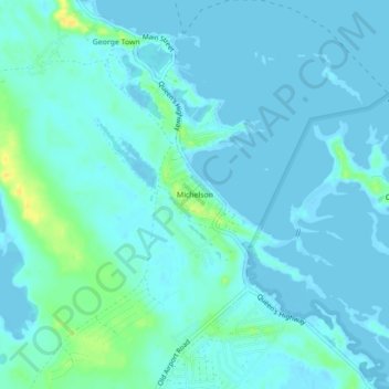
Name: Michelson topographic map, elevation, terrain.

Location: Michelson, Exuma, The Bahamas (23.47076 -75.78618 23.51076 -75.74618)

Average elevation: 13 ft

Minimum elevation: -7 ft

Maximum elevation: 79 ft

Other topographic maps

Click on a map to view its topography, its elevation and its terrain.

Little Exuma Island

The Bahamas > Exuma

Little Exuma Island, Exuma, The Bahamas

Average elevation: 3 ft

Musha Cay

The Bahamas > Exuma

Musha Cay, Exuma, The Bahamas

Average elevation: 3 ft

Normans Pond Cay

The Bahamas > Exuma

Normans Pond Cay, Exuma, The Bahamas

Average elevation: 0 ft

Hog Cay

The Bahamas > Exuma

Hog Cay, Exuma, The Bahamas

Average elevation: 0 ft