
Nalbari topographic map
Interactive map
Click on the map to display elevation.
About this map
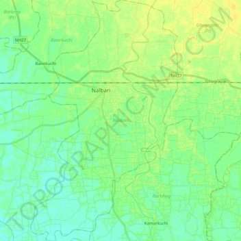
Name: Nalbari topographic map, elevation, terrain.
Location: Nalbari, Assam, India (26.33602 91.37841 26.51061 91.49723)
Average elevation: 167 ft
Minimum elevation: 141 ft
Maximum elevation: 200 ft