
Ljubečna topographic map
Interactive map
Click on the map to display elevation.
About this map
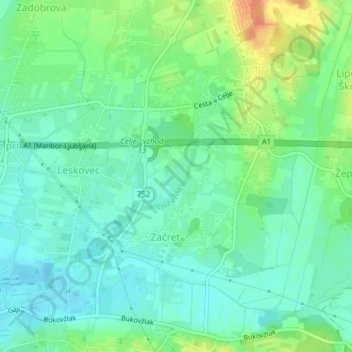
Name: Ljubečna topographic map, elevation, terrain.
Location: Ljubečna, Začret, Celje, 3202, Slovenia (46.24928 15.31014 46.25432 15.31676)
Average elevation: 820 ft
Minimum elevation: 778 ft
Maximum elevation: 909 ft