
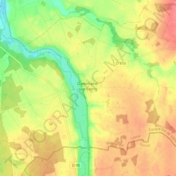
Dammarie-sur-Loing topographic map
Interactive map
Click on the map to display elevation.
About this map
Name: Dammarie-sur-Loing topographic map, elevation, terrain.
Average elevation: 525 ft
Minimum elevation: 400 ft
Maximum elevation: 620 ft
Other topographic maps
Click on a map to view its topography, its elevation and its terrain.
Bruxelles
France > Centre-Val de Loire > Loiret > Dammarie-sur-Loing > Bruxelles
Bruxelles, Dammarie-sur-Loing, Montargis, Loiret, Centre-Val de Loire, France métropolitaine, 45230, France
Average elevation: 528 ft