
Crema topographic map
Interactive map
Click on the map to display elevation.
About this map
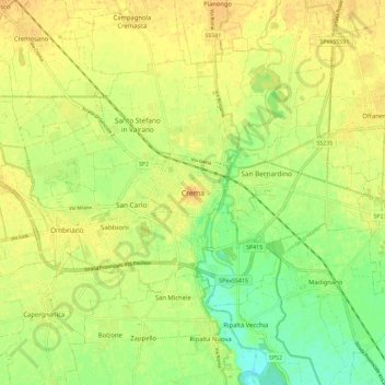
Name: Crema topographic map, elevation, terrain.
Location: Crema, Cremona, Lombardia, 26013, Italia (45.32283 9.64746 45.40283 9.72746)
Average elevation: 253 ft
Minimum elevation: 197 ft
Maximum elevation: 289 ft