
Pedanía Parroquia topographic map
Interactive map
Click on the map to display elevation.
About this map
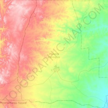
Name: Pedanía Parroquia topographic map, elevation, terrain.
Average elevation: 2,451 ft
Minimum elevation: 1,575 ft
Maximum elevation: 3,606 ft
Other topographic maps
Click on a map to view its topography, its elevation and its terrain.
Villa Tulumba
Argentina > Córdoba > Pedanía Parroquia > Villa Tulumba
Villa Tulumba, Municipio de Villa Tulumba, Pedanía Parroquia, Departamento Tulumba, Córdoba, X5203, Argentina
Average elevation: 2,303 ft