
Parque Nacional Cotopaxi topographic map
Interactive map
Click on the map to display elevation.
About this map
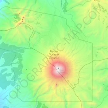
Name: Parque Nacional Cotopaxi topographic map, elevation, terrain.
Average elevation: 12,999 ft
Minimum elevation: 10,262 ft
Maximum elevation: 19,252 ft
Other topographic maps
Click on a map to view its topography, its elevation and its terrain.
Santa Ana del Pedregal
Ecuador > Pichincha > Machachi > Santa Ana del Pedregal
Santa Ana del Pedregal, Machachi, Mejía, Pichincha, Ecuador
Average elevation: 11,594 ft