
Mount Osmond topographic map
Interactive map
Click on the map to display elevation.
About this map
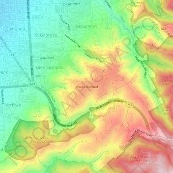
Name: Mount Osmond topographic map, elevation, terrain.
Average elevation: 853 ft
Minimum elevation: 249 ft
Maximum elevation: 1,598 ft
Other topographic maps
Click on a map to view its topography, its elevation and its terrain.
Stonyfell
Australia > South Australia > Mount Osmond
Stonyfell, Mount Osmond, City of Burnside, South Australia, 5066, Australia
Average elevation: 771 ft