
Castrillo de Riopisuerga topographic map
Interactive map
Click on the map to display elevation.
About this map
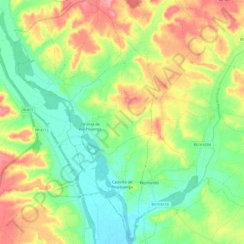
Name: Castrillo de Riopisuerga topographic map, elevation, terrain.
Location: Castrillo de Riopisuerga, Burgos, Castilla y León, España (42.49335 -4.30535 42.58167 -4.23790)
Average elevation: 2,785 ft
Minimum elevation: 2,644 ft
Maximum elevation: 2,979 ft