
Mamburao topographic map
Interactive map
Click on the map to display elevation.
About this map
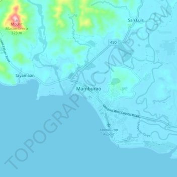
Name: Mamburao topographic map, elevation, terrain.
Location: Mamburao, Occidental Mindoro, Mimaropa, 5103, Philippines (13.18483 120.55603 13.26483 120.63603)
Average elevation: 56 ft
Minimum elevation: 0 ft
Maximum elevation: 1,014 ft
Other topographic maps
Click on a map to view its topography, its elevation and its terrain.
Balansay
Philippines > Occidental Mindoro > Mamburao
Balansay, Mamburao, Occidental Mindoro, Mimaropa, Philippines
Average elevation: 335 ft