
Jervis Bay Territory topographic map
Interactive map
Click on the map to display elevation.
About this map
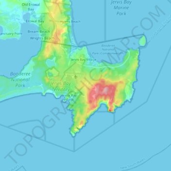
Name: Jervis Bay Territory topographic map, elevation, terrain.
Location: Jervis Bay Territory, Australia (-35.20085 150.59237 -35.11215 150.77257)
Average elevation: 46 ft
Minimum elevation: -3 ft
Maximum elevation: 538 ft