
Lieboch topographic map
Interactive map
Click on the map to display elevation.
About this map
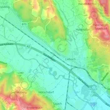
Name: Lieboch topographic map, elevation, terrain.
Location: Lieboch, Graz-Umgebung, Styria, 8501, Austria (46.95302 15.29790 47.00042 15.36962)
Average elevation: 1,158 ft
Minimum elevation: 1,047 ft
Maximum elevation: 1,407 ft