
Millport topographic map
Interactive map
Click on the map to display elevation.
About this map
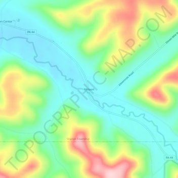
Name: Millport topographic map, elevation, terrain.
Location: Millport, Potter County, Pennsylvania, USA (41.90507 -78.13945 41.94507 -78.09945)
Average elevation: 1,781 ft
Minimum elevation: 1,503 ft
Maximum elevation: 2,323 ft