
Penglai topographic map
Interactive map
Click on the map to display elevation.
About this map
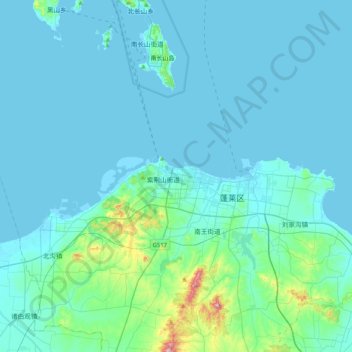
Name: Penglai topographic map, elevation, terrain.
Location: Penglai, Penglai City, Yantai City, Shandong, 265600, China (37.65377 120.59995 37.97377 120.91995)
Average elevation: 112 ft
Minimum elevation: -10 ft
Maximum elevation: 1,257 ft