
Verdun topographic map
Interactive map
Click on the map to display elevation.
About this map
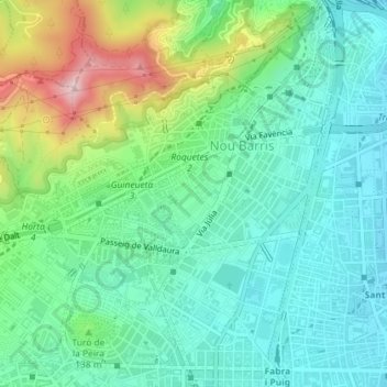
Name: Verdun topographic map, elevation, terrain.
Location: Verdun, Nou Barris, Barcelona, BCN, Catalunha, Espanha (41.43901 2.17175 41.44592 2.17975)
Average elevation: 338 ft
Minimum elevation: 66 ft
Maximum elevation: 1,040 ft
Other topographic maps
Click on a map to view its topography, its elevation and its terrain.