
Mole Valley topographic map
Interactive map
Click on the map to display elevation.
About this map
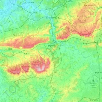
Name: Mole Valley topographic map, elevation, terrain.
Location: Mole Valley, Surrey, South East, England, United Kingdom (51.10515 -0.43846 51.33509 -0.17657)
Average elevation: 308 ft
Minimum elevation: 49 ft
Maximum elevation: 948 ft
Other topographic maps
Click on a map to view its topography, its elevation and its terrain.
Box Hill
United Kingdom > England > Mole Valley > Pixham
Box Hill, Pixham, Mole Valley, Surrey, South East, England, RH4 1NT, United Kingdom
Average elevation: 344 ft