
Malankara Dam topographic map
Interactive map
Click on the map to display elevation.
About this map
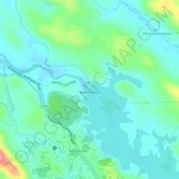
Name: Malankara Dam topographic map, elevation, terrain.
Average elevation: 194 ft
Minimum elevation: 92 ft
Maximum elevation: 509 ft
Other topographic maps
Click on a map to view its topography, its elevation and its terrain.
Kolapra South
India > Kerala > Thodupuzha > Muttam
Kolapra South, Muttam, Thodupuzha, Idukki District, Kerala, India
Average elevation: 1,096 ft