
Isernhagen topographic map
Interactive map
Click on the map to display elevation.
About this map
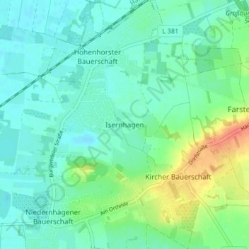
Name: Isernhagen topographic map, elevation, terrain.
Location: Isernhagen, Region Hannover, Niedersachsen, Deutschland (52.45048 9.78800 52.49048 9.82800)
Average elevation: 184 ft
Minimum elevation: 144 ft
Maximum elevation: 282 ft
Other topographic maps
Click on a map to view its topography, its elevation and its terrain.
Lehrte
Deutschland > Niedersachsen > Region Hannover
Lehrte, Region Hannover, Niedersachsen, 31275, Deutschland
Average elevation: 210 ft
Hühnenberg
Deutschland > Niedersachsen > Region Hannover > Neustadt am Rübenberge
Hühnenberg, Neustadt am Rübenberge, Region Hannover, Niedersachsen, Deutschland
Average elevation: 157 ft