
Lack topographic map
Interactive map
Click on the map to display elevation.
About this map
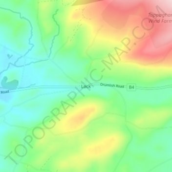
Name: Lack topographic map, elevation, terrain.
Average elevation: 515 ft
Minimum elevation: 226 ft
Maximum elevation: 1,047 ft
Other topographic maps
Click on a map to view its topography, its elevation and its terrain.
Enniskillen
Vereinigtes Königreich > Nordirland > County Fermanagh > Enniskillen
Enniskillen, County Fermanagh, Ulster, Nordirland, BT74 7DH, Vereinigtes Königreich
Average elevation: 217 ft