
Byron Glacier topographic map
Interactive map
Click on the map to display elevation.
About this map
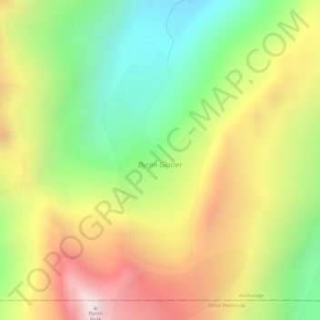
Name: Byron Glacier topographic map, elevation, terrain.
Location: Byron Glacier, Byron Glacier Trail, Anchorage, Alaska, USA (60.73632 -148.86451 60.75495 -148.84526)
Average elevation: 2,457 ft
Minimum elevation: 591 ft
Maximum elevation: 4,695 ft
Other topographic maps
Click on a map to view its topography, its elevation and its terrain.
Mount Alyeska
Mount Alyeska, Anchorage, Alaska, USA
Average elevation: 2,336 ft