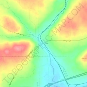
Smyrna Mills topographic map
Interactive map
Click on the map to display elevation.
About this map
Name: Smyrna Mills topographic map, elevation, terrain.
Average elevation: 689 ft
Minimum elevation: 541 ft
Maximum elevation: 860 ft

Click on the map to display elevation.
Name: Smyrna Mills topographic map, elevation, terrain.
Average elevation: 689 ft
Minimum elevation: 541 ft
Maximum elevation: 860 ft