
Gozdnica topographic map
Interactive map
Click on the map to display elevation.
About this map
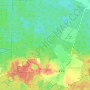
Name: Gozdnica topographic map, elevation, terrain.
Location: Gozdnica, Żagań County, Lubusz Voivodeship, 68-130, Poland (51.42536 15.04732 51.48196 15.12405)
Average elevation: 486 ft
Minimum elevation: 417 ft
Maximum elevation: 594 ft