Ait Messaoud topographic map
Interactive map
Click on the map to display elevation.
About this map
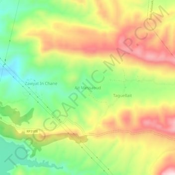
Name: Ait Messaoud topographic map, elevation, terrain.
Average elevation: 3,251 ft
Minimum elevation: 2,631 ft
Maximum elevation: 3,930 ft

Click on the map to display elevation.
Name: Ait Messaoud topographic map, elevation, terrain.
Average elevation: 3,251 ft
Minimum elevation: 2,631 ft
Maximum elevation: 3,930 ft