
Weißenhaid topographic map
Interactive map
Click on the map to display elevation.
About this map
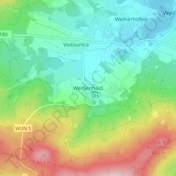
Name: Weißenhaid topographic map, elevation, terrain.
Average elevation: 2,287 ft
Minimum elevation: 2,005 ft
Maximum elevation: 2,844 ft
Other topographic maps
Click on a map to view its topography, its elevation and its terrain.
Weißenstädter See
Deutschland > Bayern > Landkreis Wunsiedel im Fichtelgebirge > Weißenstadt > Weiherhöfen
Weißenstädter See, Weihermühle, Weiherhöfen, Weißenstadt, Landkreis Wunsiedel im Fichtelgebirge, Bayern, 95163, Deutschland
Average elevation: 2,060 ft