
East Galesburg topographic map
Interactive map
Click on the map to display elevation.
About this map
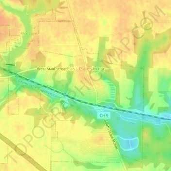
Name: East Galesburg topographic map, elevation, terrain.
Location: East Galesburg, Knox County, Illinois, 61430, United States (40.93298 -90.32634 40.95725 -90.29797)
Average elevation: 764 ft
Minimum elevation: 686 ft
Maximum elevation: 804 ft
Other topographic maps
Click on a map to view its topography, its elevation and its terrain.
Dahinda
United States > Illinois > Knox County
Dahinda, Knox County, Illinois, 61428, United States
Average elevation: 646 ft
Galesburg
United States > Illinois > Knox County
Galesburg, Knox County, Illinois, United States
Average elevation: 778 ft