
Tamshiyacu topographic map
Interactive map
Click on the map to display elevation.
About this map
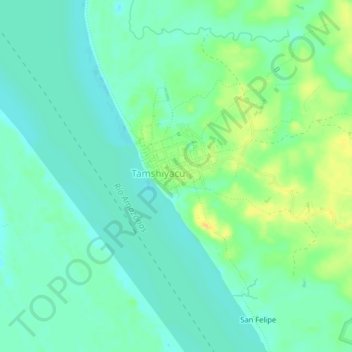
Name: Tamshiyacu topographic map, elevation, terrain.
Location: Tamshiyacu, Provincia de Maynas, Loreto, Perú (-4.02330 -73.17855 -3.98330 -73.13855)
Average elevation: 302 ft
Minimum elevation: 269 ft
Maximum elevation: 361 ft