
Glacier de Montay topographic map
Interactive map
Click on the map to display elevation.
About this map
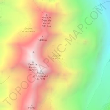
Name: Glacier de Montay topographic map, elevation, terrain.
Average elevation: 9,301 ft
Minimum elevation: 6,411 ft
Maximum elevation: 12,028 ft
Other topographic maps
Click on a map to view its topography, its elevation and its terrain.
Glacier de Pièce
Switzerland > Valais/Wallis > Evolène
Glacier de Pièce, Arolla - Cabane de la Tsa, Tsijiore Nouve, Evolène, Hérens, Valais/Wallis, 1983, Switzerland
Average elevation: 9,498 ft
Dent Blanche
Switzerland > Valais/Wallis > Evolène
Dent Blanche, Evolène, Hérens, Valais/Wallis, 1983, Switzerland
Average elevation: 11,345 ft