Geolocate

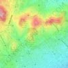
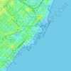
la Salut topographic map

Click on the map to display elevation.

About this map

Name: la Salut topographic map, elevation, terrain.

Location: la Salut, Barcelona, Barcelonès, Barcelona, Catalonia, Spain (41.40777 2.14803 41.41676 2.16204)

Average elevation: 413 ft

Minimum elevation: 138 ft

Maximum elevation: 850 ft

Other topographic maps

Click on a map to view its topography, its elevation and its terrain.
Barcelona

Spain > Catalonia > Barcelonès > Barcelona

Average elevation: 213 ft

Park Guell

Spain > Catalonia > Barcelonès > Barcelona

Average elevation: 436 ft

Park Guell

Spain > Catalonia > Barcelonès > Barcelona

Average elevation: 436 ft

Park Güell

Spain > Catalonia > Barcelonès > Barcelona

Average elevation: 433 ft

Parc del Guinardó

Spain > Catalonia > Barcelonès > Barcelona

Average elevation: 331 ft

Montjuïc

Spain > Catalonia > Barcelonès > Barcelona

Average elevation: 128 ft

Montjuïc

Spain > Catalonia > Barcelonès > Barcelona

Average elevation: 128 ft

la Vila de Gràcia

Spain > Catalonia > Barcelonès > Barcelona

Average elevation: 292 ft

Plaça de Calvó

Spain > Catalonia > Barcelonès > Barcelona

Average elevation: 630 ft

Gear up for your next adventure:

🧢Sun Protection Hats - Wide-brimmed and UPF-rated hats for high-altitude sun safety
📖Nature Tracking Books - Learn to track wildlife and terrain
🛡️Bear Spray Outdoor - Protection in bear country hikes
🧭Outdoor Navigation Book - Learn advanced navigation skills
🍳Camping Cook Set - Complete cookware for outdoor meals

As an Amazon Associate, this site earns from qualifying purchases at no extra cost to you.