
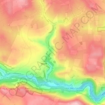
Tideswell Dale topographic map
Interactive map
Click on the map to display elevation.
About this map
Name: Tideswell Dale topographic map, elevation, terrain.
Average elevation: 958 ft
Minimum elevation: 614 ft
Maximum elevation: 1,158 ft
Other topographic maps
Click on a map to view its topography, its elevation and its terrain.
Cressbrook Dale
United Kingdom > England > Derbyshire > Derbyshire Dales > Litton CP > Litton Mill
Cressbrook Dale, Litton Mill, Litton CP, Cressbrook, Derbyshire Dales, Derbyshire, England, SK17 8ST, United Kingdom
Average elevation: 938 ft