
Then Pennai topographic map
Interactive map
Click on the map to display elevation.
About this map
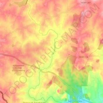
Name: Then Pennai topographic map, elevation, terrain.
Location: Then Pennai, Hosur, Krishnagiri, Tamil Nadu, 635109, India (12.68614 77.87454 12.77079 77.90419)
Average elevation: 2,717 ft
Minimum elevation: 2,418 ft
Maximum elevation: 2,887 ft
Other topographic maps
Click on a map to view its topography, its elevation and its terrain.
Zuzuvadi
India > Tamil Nadu > Hosur > Zuzuvadi
Zuzuvadi, Hosur, Krishnagiri District, Tamil Nadu, 635109, India
Average elevation: 2,877 ft