
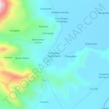
Chucallani / Sachacanto topographic map
Interactive map
Click on the map to display elevation.
About this map
Name: Chucallani / Sachacanto topographic map, elevation, terrain.
Location: Chucallani / Sachacanto, Cupi, Melgar, Puno, Perú (-14.92261 -70.88360 -14.88261 -70.84360)
Average elevation: 13,281 ft
Minimum elevation: 12,936 ft
Maximum elevation: 15,010 ft
Other topographic maps
Click on a map to view its topography, its elevation and its terrain.
Santa Lucia
Perú > Puno > Cupi > Santa Lucia
Santa Lucia, Cupi, Provincia de Melgar, Puno, Perú
Average elevation: 12,897 ft