
Kumejima topographic map
Interactive map
Click on the map to display elevation.
About this map
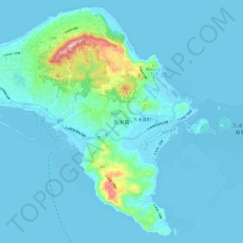
Name: Kumejima topographic map, elevation, terrain.
Location: Kumejima, Shimajiri, Okinawa Prefecture, Japan (26.29094 126.70776 26.39135 126.82635)
Average elevation: 102 ft
Minimum elevation: 0 ft
Maximum elevation: 1,033 ft