Geolocate

Biga topographic map

Click on the map to display elevation.

About this map

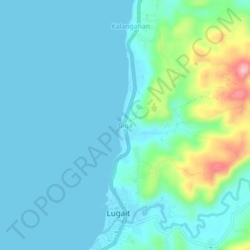
Name: Biga topographic map, elevation, terrain.

Location: Biga, Misamis Oriental, Northern Mindanao, 9025, Philippines (8.33721 124.24090 8.37721 124.28090)

Average elevation: 98 ft

Minimum elevation: -10 ft

Maximum elevation: 571 ft

Other topographic maps

Click on a map to view its topography, its elevation and its terrain.

Gingoog

Philippines > Misamis Oriental

Average elevation: 1,470 ft

Gear up for your next adventure:

🖼️Topo Map Wall Art - Decorative topographic prints of famous peaks and regions
📖Nature Tracking Books - Learn to track wildlife and terrain
🏫Relief Map Kits - Hands-on tools for teaching landforms and elevation
🪄Magnetic Compass - Accurate compass for navigation
🧭Compass with Lanyard - Easy‑carry compass for navigation

As an Amazon Associate, this site earns from qualifying purchases at no extra cost to you.