
Ben M'Hidi topographic map
Interactive map
Click on the map to display elevation.
About this map
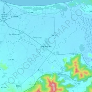
Name: Ben M'Hidi topographic map, elevation, terrain.
Location: Ben M'Hidi, Daïra Ben M'Hidi, El Tarf, Algérie (36.69325 7.86588 36.84864 8.06868)
Average elevation: 89 ft
Minimum elevation: -10 ft
Maximum elevation: 1,499 ft
Other topographic maps
Click on a map to view its topography, its elevation and its terrain.
Berrihane
Algérie > El Tarf > Daïra Ben M'Hidi
Berrihane, Daïra Ben M'Hidi, El Tarf, 36027, Algérie
Average elevation: 144 ft