Chalet à Mathey topographic map
Interactive map
Click on the map to display elevation.
About this map
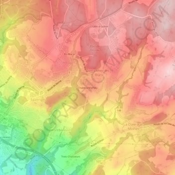
Name: Chalet à Mathey topographic map, elevation, terrain.
Average elevation: 2,651 ft
Minimum elevation: 2,051 ft
Maximum elevation: 2,959 ft

Click on the map to display elevation.
Name: Chalet à Mathey topographic map, elevation, terrain.
Average elevation: 2,651 ft
Minimum elevation: 2,051 ft
Maximum elevation: 2,959 ft